This 5 stage trip will take us through the mountains of the Andes to the coffee lands of Colombia. On this tour we will get to know the different Colombian cultures, the different types of vegetation and fauna and, of course, the trip will test your physical and mental strength. Our staff will make sure you only have to worry about having fun!
Welcome to Colombia! We will be waiting for you at 2:00
PM in the MOVICH HOTEL located in Rionegro, Antioquia.
We will have a short welcome brief and pur mechanics
will help youa assamble your bike.Later in the afternoon
we will host our welcome dinner!
2
Day
APROX DURATION. 3:12:54 Distance 77,66 km ELEVATION GAIN 1.257 mts MAX ALTITUDE 2.511 Masl CLIMB OF THE DAY Alto de la Unión (Distancia: 7,3 km, Pendiente media: 5,1%)
1
Stage
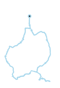
loop
rionegro
STAGE PROFILE
Today we have our first contact with the
Colombian roads. We are going to do an
extended version of what locals call the
VUELTA A ORIENTE.
This is a ride that many
colombian pros do everyday and with a little
bit of luck we will cross some of
them.
This stage will lead us to Guatapé, one of the
most beatiful landscapes of Colombia. In here
you can rest and meet the colofull streets of
the downtown.
APROX DURATION. 2:03:29 Distance 40,19 km ELEVATION GAIN 292 mts MAX ALTITUDE 244 Masl CLIMB OF THE DAY n/a
Today we move down to the Magdalena valley.
We will do a 4 hour car transfer from Guatape
to La Dorada, in here you can decide if you want
to ride the last 40 kms into Honda.
You will have the afternoon to rest and enjoy
the Colonial hotel we are going to sleep in. At
night we will make a technical talk about how
to tackle the ALTO de Letras!
2
Stage
DORADA (optional)
Honda
STAGE PROFILE
4
Day
APROX DURATION. 6:35:23 Distance 80 km ELEVATION GAIN 3.750 mts MAX ALTITUDE 3.700 Msnm CLIMB OF THE DAY Alto de Letras (Distancia: 80km, Pendiente Media: 4%)
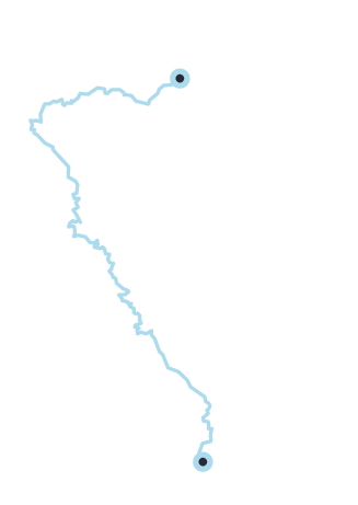
3
stage
MARIQUITA
Letras
STAGE PROFILE
The queen stage is here; today Colombia
will test your physical and mental
strength. This, the longest paved climb in
world will graduate you as a cyclist and
will give the triumph you came here to
obtain.
Afterwards we will rest in a natural
hotsprings hotel where you can rest and
celebrate.
5
Day
APROX DURATION. 2:27:01 Distance 47,86 km ELEVATION GAIN 846 mts MAX ALTITUDE 2.100 Masl CLIMB OF THE DAY Alto de la paz (Distancia: 2,08km, Pendiente media: 7%)
4
Stage
Manizales
Santagueda
STAGE PROFILE
Although it`ll be difficult to get back on the bike,
today we have a recovery ride going through
terrific landscapes, we finally have reached the
coffee lands. After drinking an authentic Juan
Valdez coffee and getting to know Manizales we´ll
get in our way.
We will have our first contact with the Colombian
coffee plantations and at the end of the ride we
will rest in a private pool house.
6
Day
APROX DURATION. 5:11:00 Distance 119,07 km ELEVATION GAIN 3.127 mts MAX ALTITUDE 1.900 Msnm CLIMB OF THE DAY Alto de Belalcazar (Distancia: 16.80 km, Pendiente media:3.4%)
5
Stage
Santagueda
filandia
STAGE PROFILE
Now we dive into the coffee lands and we start the ride
that will take us to Filandia. We´ll go through beautiful
colonial towns such as Belalcazar and we will end at
Filandia. This a really hard an hot stage, you will have to
give whatever you have left in the tank.
At the end of the stage we will arrive to the only
latinamerican hotel designed for cyclists! At night we
will host the farewell dinner!
7
Day
goodbye!
After breakfast we will drive
you to the airport of Pereira.
We hope you´ve had a great
week!
Fechas y Precios
$USD 2.350 per person. To book (30% down payment)
Add-Ons
*Bike rental: 50 USD per day *Ground transportation to Manizales: $USD 200 from Bogotá or Cali (Available for groups of 8 people). *Single accomodation $USD 400 per person (Subject to availabilty)